

微信扫码分享
Midtown Oakville: A Strategic Urban Growth Centre
Introduction
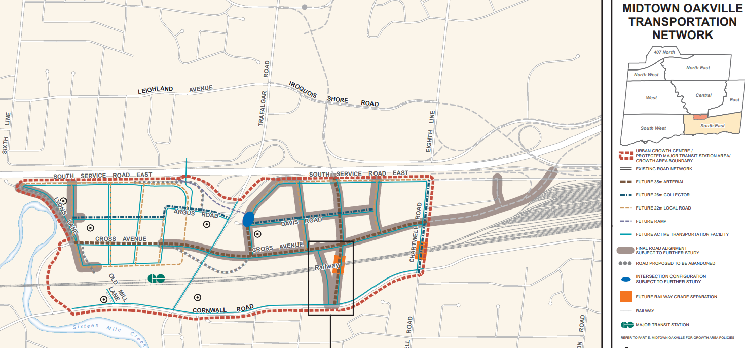
Midtown Oakville is the Town’s primary strategic growth area, envisioned to accommodate a significant portion of the Town and Region’s required intensification until 2051 and beyond. Covering approximately 103 hectares, it is bounded by the QEW/Highway 403 to the north, Chartwell Road to the east, Cornwall Road to the south, and the Sixteen Mile Creek valley to the west.
Strategic Location and Transit Connectivity
This urban growth center and protected major transit station area is strategically positioned along the Lakeshore West GO provincial priority transit corridor. It is centered around the Oakville GO/VIA Station, serving as the Town’s primary hub for current and future transit services. Currently, the area is served by regional and inter-regional rail and local and inter-regional bus systems, including Via Rail, GO Transit, and Oakville Transit. Future plans include the integration of bus rapid transit (BRT) systems, connecting Midtown Oakville with the broader Greater Toronto and Hamilton Area (GTHA) transportation network.

Growth Plan and Development Requirements
Designated as one of the 25 urban growth centers in the Province’s Growth Plan for the Greater Golden Horseshoe since 2006, Midtown Oakville holds a critical role in accommodating future population and employment growth. The Growth Plan mandates that Midtown Oakville achieve a minimum density target of 200 residents and jobs combined by 2031. The Town, in collaboration with regional and provincial partners, is committed to implementing a comprehensive plan to provide the necessary infrastructure, programs, services, and incentives for development.
Goals: Create a Vibrant, People-Oriented, and Transit-Supportive Community
- Establish a mix of high-density and compact residential, commercial, and employment uses, along with educational facilities and public service facilities. Enhance public spaces with open areas and public art to attract diverse users throughout the day and year-round.
- Foster a continuous, well-connected, and robust public realm, emphasizing human interactions and active uses at the street level.
- Uphold high urban design and architectural standards for both development projects and the public realm.
- Facilitate public investments in transit, infrastructure, and public service facilities, ensuring that development density aligns with the required infrastructure through the town’s planning approval process.
- Coordinate the provision of future roads and transportation infrastructure as development progresses, ensuring timely support for new residents and employees.
- Promote the use of district energy and sustainable building practices, in alignment with the Oakville Community Energy Strategy.
- Direct major office and appropriate large-scale institutional developments to Midtown Oakville.
Objectives
As Midtown Oakville evolves, the Town will utilize the following objectives to guide decision-making in reviewing planning applications and development proposals:
-
To create a vibrant, people-oriented, transit-supportive, and complete community by
a) providing a mix of high-density and compact residential, commercial, and employment uses, educational facilities, and public service facilities, complemented by publicly accessible open spaces and public art, to attract different users throughout the day and year-round;b) creating a continuous, well-connected, and robust public realm focused on human interactions and active uses at grade;c) ensuring a high standard of urban design and architectural quality for development and the public realm;d) facilitating public investment in transit, infrastructure, and public service facilities to support growth by matching density with required infrastructure through the town’s planning approval process;e) Requiring that the provision of future roads and other transportation infrastructure shall be coordinated as development progresses to ensure that transportation infrastructure is provided for new residents and employees in a timely manner;f) promoting the use of district energy and sustainable building practices, in alignment with the Oakville Community Energy Strategy; and,g) directing major office and appropriate large-scale institutional development to Midtown Oakville.
-
To create transit-supportive communities by:
a) ensuring the entire area is developed as a place that prioritizes people,active transportation and transit;b) improving connections to and through Midtown Oakville for activetransportation and public transit;c) reducing parking standards over time to promote transit ridership andfacilitate mixed-use development;d) ensuring a compact urban form with high density and high intensityland uses while providing a high-quality, active transportation-focusedpublic realm; and,e) aligning the planning and implementation of transit-supportiveinfrastructure, transit services and operations with new and existingdevelopment.
-
To enable the evolution of Midtown Oakville as an urban growth center and the Town’s primary growth area by:
a) planning for a minimum gross density of 200 residents and jobscombined per hectare – a minimum of 20,600 residents and jobs – byin accordance with the Growth Plan;b) ensuring that development occurs in a comprehensive and progressivemanner by monitoring key development indicators at regular intervals;and,c) ensuring future population growth, beyond 2051, is accommodatedthrough sufficient infrastructure planning.
-
To attract new investment, and retain and grow existing businesses to enhance the economic development of Midtown Oakville by:
a) promoting the economic function of the Midtown Oakville area byproviding a mix of office and other uses to support employment;b) promoting partnerships with existing post-secondary institutions,economic development and innovation organizations, and localbusinesses to support new and emerging companies; and,c) introducing an incentive strategy, policies, and zoning regulations,informed by an economic development strategy, that will promote andsupport business and talent attraction goals.
Midtown Community Framework
In addition to the policies in Parts C and D of this Plan, the followingpolicies apply specifically to Midtown Oakville. They set out the frameworkof components required to build the community envisioned by this Plan.Midtown Oakville shall be designed as a regional destination and urbancommunity with a compact form, complete with a mix of building forms andtypes, which will include tall and midrise buildings, framing a public realmthat prioritizes active transportation and transit use. New developmentsand public realm improvements shall support this direction.
-
Population and Employment
a) In accordance with the Growth Plan, Midtown Oakville has beenplanned to achieve a minimum gross density of 200 residents and jobscombined per hectare by 2031. Based on its gross area of 103hectares, this translates to a minimum of 20,600 residents and jobs.b) An overall mix of at least 7,875 residential units and a gross floor arearanging from 165,000 to 510,000 square metres of retail, servicecommercial and employment space should be accommodated toprovide for a minimum of approximately 13,390 residents and 7,210jobs.
-
Public Realm
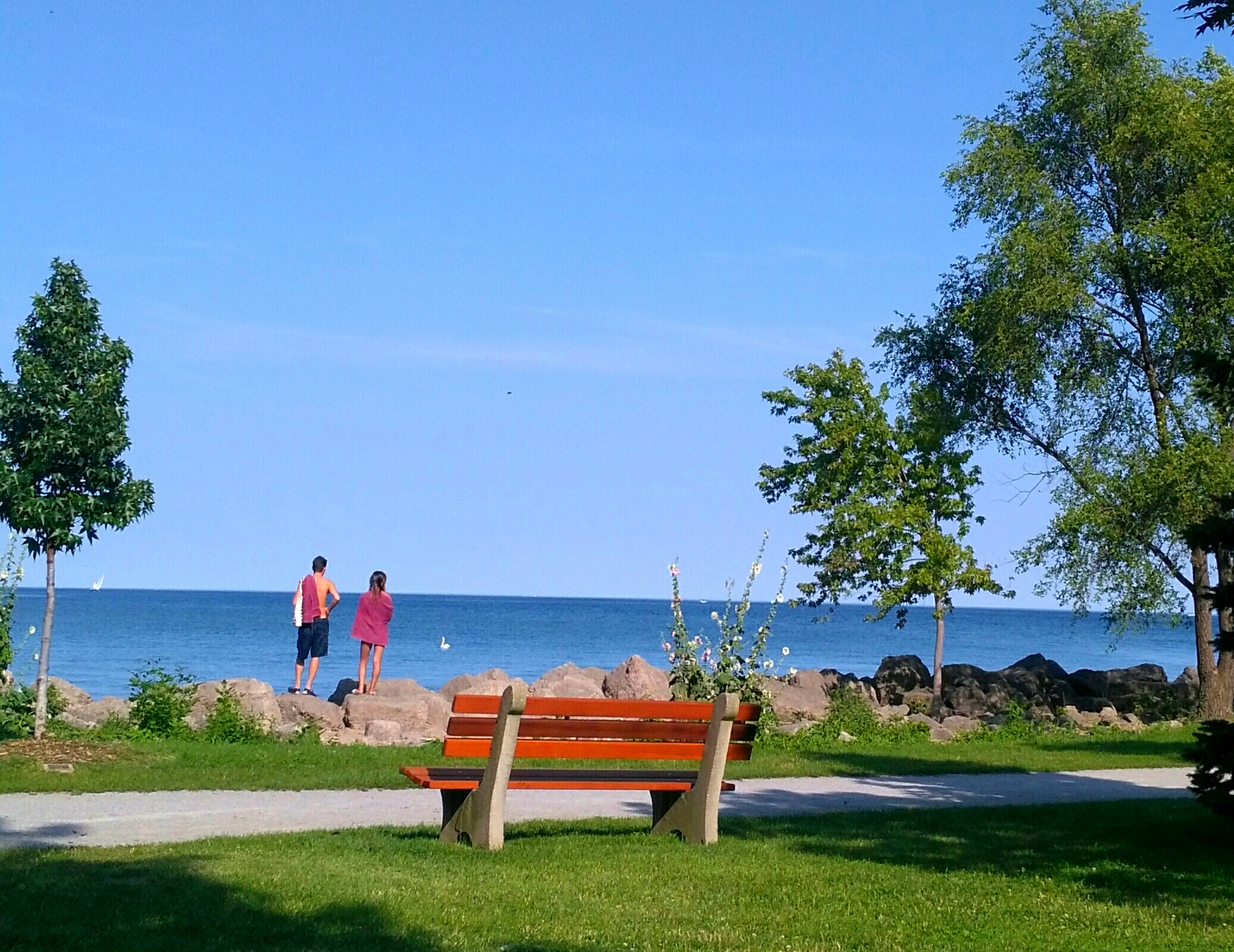
A major feature of Midtown Oakville will be its public realm – comprised ofa “campus of parks”, public streets, as well as privately-owned publiclyaccessible open spaces (POPS) – designed to create a desirable place forresidents, workers, and visitors alike.As a compact urban community and destination, the planning, design, andimplementation of the public realm in Midtown Oakville will be influencedby the Urban Park Hierarchy for strategic growth areas, outlined in theTown’s Parks Plan. Urban park spaces are diverse, flexible andconnected, contain a mixture of green and hardscape design components,and are inherently connected to the public realm.The urban parkland system includes primarily public spaces but can alsoinclude semi-public spaces and private components that form aninterconnected network, animated by people who walk from place to place.[caption id="attachment_17" align="alignnone" width="300"]
lakeview oakville, photo taken by Charles Yang, copy right reserved[/caption]Key components of the urban parkland system that will influence theMidtown Oakville public realm include the following:
- Public commons, which are large social and recreational focal
points that meet the needs of the local community, support abalance of active and passive uses, and shall be coordinated withurban school sites, where possible. Public commons accommodatespecial features that contribute to placemaking, including locationsfor public art.
- Promenades are substantial linear spaces, located between
adjacent building facades and the adjacent road right-of-way, usedto enhance the pedestrian experience together with highly activatedat-grade retail spaces. Promenades may include public art, smalloutdoor game areas, seating, places to eat and relax, as well asstreet-related activities such as vendors and exhibit spaces.
- Urban squares support community-oriented social opportunities, as
well as town-wide entertainment and cultural events depending ontheir size and location. Urban squares may include many of thesame uses and amenities as promenades.a) The public realm shall incorporate networks of accessible,interconnected and predictable pedestrian-oriented spaces and routesthat enhance walkability and other active transportation year-round,reinforce the surroundings, and provide quality spaces for public life.b) A network of urban parkland, including public parks and open spacesof varying types and sizes should be provided throughout MidtownOakville to support the needs of residents, employees, and visitors.c) The locations and delivery of urban parkland, including public parksand open spaces shall be coordinated as development progresses toensure that parks and open spaces are provided for new residents andemployees in a timely manner.d) Urban parkland, including public commons, promenades, urbansquares, connectors, and other open spaces, whether public orprivately-owned publicly accessible open spaces shall be designed,maintained, and operated as:i) flexible spaces that are passive in programming and oriented tourban activities that occur throughout the day and year-round;ii) places designed to complement the built form and public realmand incorporate hardscapes, softscapes, tree plantings,furnishings, context-sensitive lighting, and other urban amenities;and,iii) an integral part of the public realm by providing convenient activetransportation routes and places to gather and facilitate public activity. The location of servicing and the back of the house should not belocated along public frontages.e) The public realm shall include trees and landscaping, lighting,furnishings, urban amenities, wayfinding, and public art that enhancethe local context and create a sense of identity.
f) A streetscape and/or public realm master plan shall be developed for
Midtown Oakville in alignment with the Town of Oakville Streetscape
Strategy, as amended.
g) Streetscapes shall reinforce the active transportation-oriented and
urban environment and provide a seamless interface between thepublic and private realms.h) As the Town’s urban growth centre, Midtown Oakville will drawresidents, workers, and visitors from local and regional origins daily.Gateway elements are intended to provide a sense of arrival throughwell-designed built form, public art, landscaping, and streetscapetreatments that together, promote a distinctive identity and establishpoints of reference. Gateway elements should be positioned at thefollowing locations, in general accordance with Schedule L4:i) the intersection of Trafalgar Road and Cornwall Road;ii) the intersection of Trafalgar Road and the QEW/Highway 403east-bound off-ramp;iii) at the eastern and western edges of Midtown Oakville along theQEW/Highway 403.i) Parkland dedication should be provided as land for promenades,public commons, urban squares and connectors located in generalaccordance with Schedule L4, which identifies public realm elements,and may be refined through the planning approval process. Changesto the location of elements on Schedule L4, as refined through theplanning approval process, can be made without amendment to thisPlan.j) The promenades identified on Schedule L4 should generally have thefollowing minimum depth, measured from the ultimate edge of thepublic street right-of-way to the property line of the adjacent netdevelopment parcel:i) Cross Avenue, west of Trafalgar Road: 13 metres;ii) Cross Avenue, east of Trafalgar Road: 8 metres; and,iii) Davis Road: 8 metres.k) The depth of the promenades identified on Schedule L4 may bereduced below the minimum depths identified in subsection (j) to
相关文章

2026年GTA房市:这5大趋势,将决定你的钱包去向

2026年在多伦多买首套房:是“上车”好机会,还是该继续等?

特朗普当选对美国、加拿大和中国经济的影响

低利率对多伦多房价的影响

安省最新中学排名对房价的影响

加拿大资本利得税纳入率上调对房地产市场的影响

未来利率走势如何?

留学生如何租房?

安省和BC省破产人数激增!跳楼价卖Condo楼花、每月贷款根本还不起!
